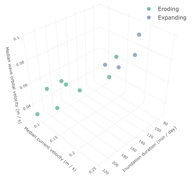
When you think about it, the transformation is incredible. With only a small change in hydrological condition, the tidal landscape totally changes, becoming either a saltmarsh or a mudflat. In ecology, this is known as a regime shift. The point at which an ecosystem shifts is known as a tipping point.
I’m using Mini Buoys to detect the exact point at which waves, currents, and inundation duration causes a saltmarsh to tip into an eroding or expanding state. 20 Mini Buoys are now gathering data along a 10 km stretch of the Caerlaverock saltmarsh in the north-west Solway Firth, Scotland.